-
 EarthCam and EsriLive views enable visual verification
within GIS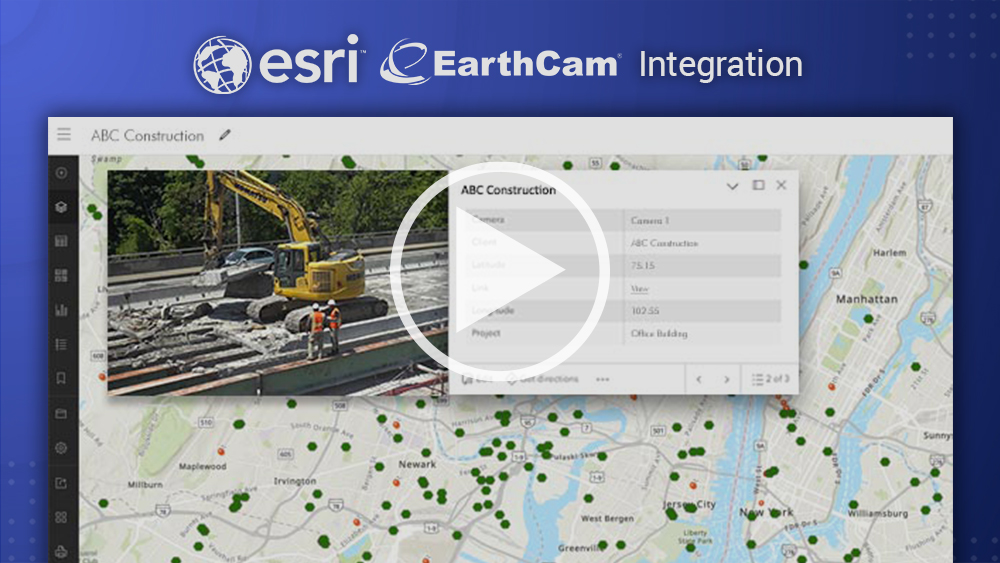
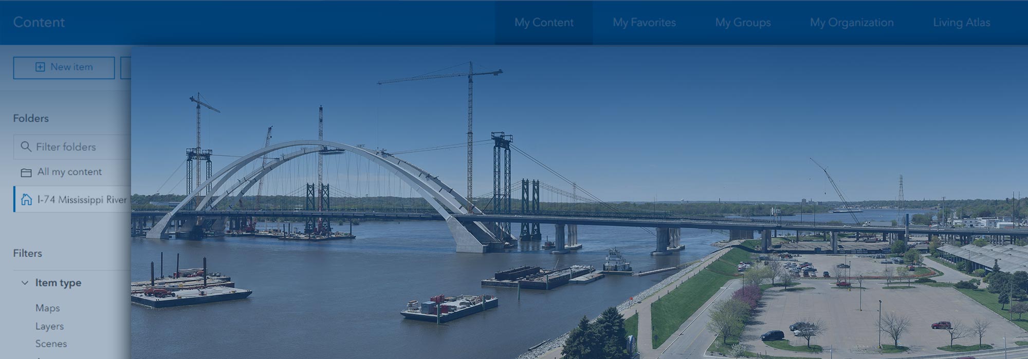
Add Live-Video Layer Inside Esri ArcGIS Online
Real-time location intelligence within Geographical Information Systems (GIS)
EarthCam Imagery & Esri Platform
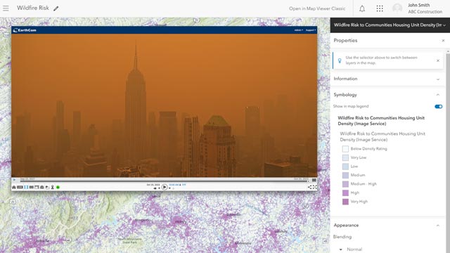
Import pinpoint locations for all your EarthCam cameras into ArcGIS Online. View highly detailed live imagery of map locations together with many layers of contextual data. Add insight to improve workflows and make real-time collaboration easy for many different commercial and governmental organizations.
![]()
Better Lives Through Visual Information®
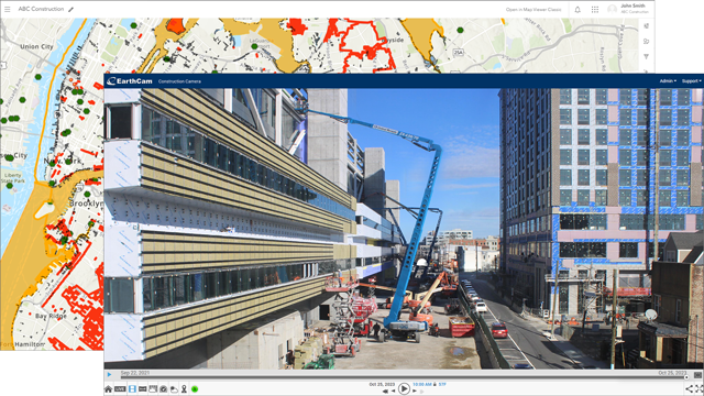
Visual Verification Inside Esri ArcGIS Online
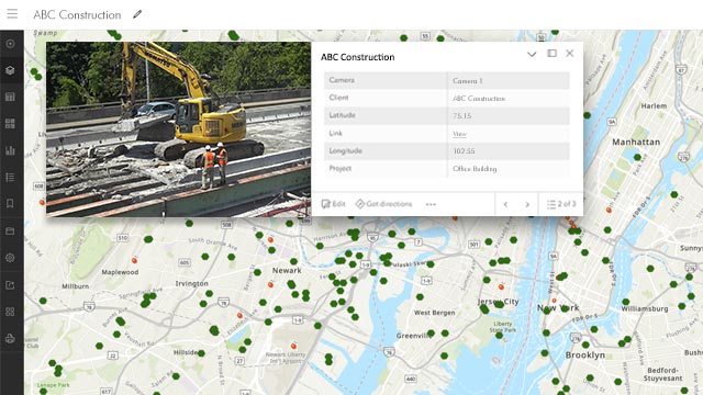
Visual Verification Inside Esri ArcGIS Online
EarthCam and Esri clients can now navigate directly to their camera from ArcGIS Online. Make proactive, informed decisions from relevant data, monitoring progress in maps, dashboards, and web apps fed from real-time location intelligence data sources.
Manage a Rapidly-Changing Environment
Live cameras have many important geospatial use-cases to visualize data layers, such as active construction, climate change, crime and many more. Real-time video powerfully augments GIS for governmental projects, virtual tourism, ecological studies and scientific research.
Live Weather Service
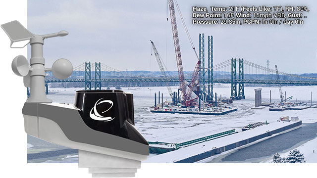
An onsite, wireless, solar-powered sensor array detects and calculates 16 points of weather and environmental data. This data is combined with NOAA observed conditions to predict and document weather events more accurately, and alert project management in seconds instead of hours.